Southeast Florida Sediment Morphodynamics Study
Introduction:
In 2019, the U.S. Army Corps of Engineers (USACE), Jacksonville District (CESAJ), Florida, embarked on a study of Palm Beach Harbor. The study’s main goals were to identify more sustainable solutions and engineering measures to improve sediment management during dredging operations, alleviate chronic shoaling and navigational restrictions, and improve sediment availability for CSRM (Coastal Storm Risk Management), beneficial use and environmental restoration projects.
Methods:
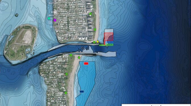
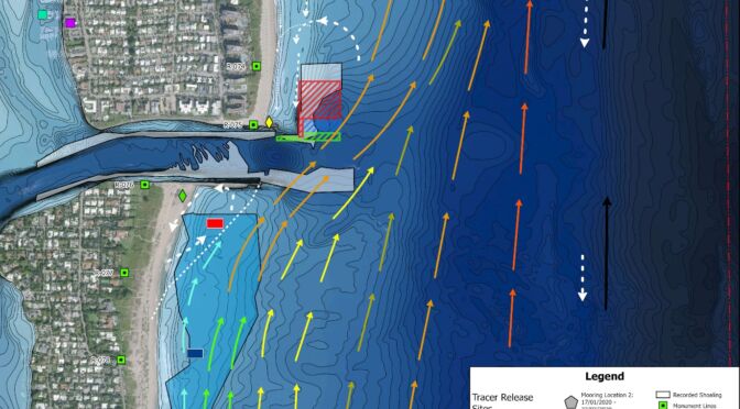
At Lake Worth Inlet (LWI), Environmental Tracing (ET) released 3 environmentally inert fluorescent sand tracers, known as EcoTrace® particles, to the north and south of the inlet. The tracers were tracked simultaneously over 7.5 months to identify different sediment sources, processes and pathways for the same metocean and environmental conditions.
Results:
The study confirmed the source of sediment that causes a bar shoal to form that encroaches into the navigation channel on the north side of the channel and ultimately leads to chronic shoaling in the inlet throat itself restricting the depth and width of the channel. Shoaling occurs despite a Sand Transfer Plant, Settling Basins and Advanced Maintenance dredging operations requiring frequent and occasionally emergency O&M dredging by the Corps.
The results confirmed the complex and dynamic interaction between tidal inlet flows (oriented E-W) with metocean processes and currents (mainly oriented N-S). Highly variable bathymetry including a relic ebb shoal to the north of the inlet increases the complexity with current flows being deflected by this feature.
Conclusion:
Results and understanding from the extensive data collection program both at LWI and along the SE Florida coastline were used to develop a conceptual model of LWI in terms of hydrodynamics and sediment transport and compared with numerical model output. The conceptual model was used to identify possible improvements and evaluate engineering solutions to minimize shoaling, extend the frequency of dredging, avoid emergency dredging and increase coastal resiliency and Regional Sediment Management (RSM) opportunities.